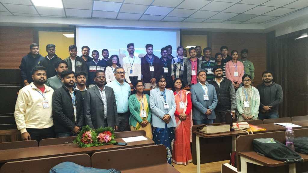

BIT Sindri hosted the National Conference on the Application of Remote Sensing and GIS, which commenced on 9th December and concluded on 13th December. The event consisted of five days of technical sessions during which experienced scholars shared their expertise in these fields.
The first day began with the grand inaugural ceremony, which started with the lighting of Deep Jyoti, a symbolic gesture of knowledge.
Further, Dr. Pankaj Rai, Director BIT Sindri, addressed the students with motivating words. They showed their heartfelt gratitude towards the resource person and the chief guest of this grand conference, Dr. Nilanchal Patel, a well-known professor of remote sensing at BIT Mesra. With more than 25 years of experience in the field, he shared insightful perspectives on remote sensing and GIS.
The first session finally concluded with a thoughtful vote of thanks presented by Dr. B.D. Yadav.
The latter half of the event was adorned by a technical session, Application of RS & GIS in Groundwater and Natural Resource Management by Dr. Madhumita Sahoo.
Further, Dr. Komal Kumari, Assistant Professor, BIT Sindri, presented the vote of thanks to panel for sharing expertise with the students.
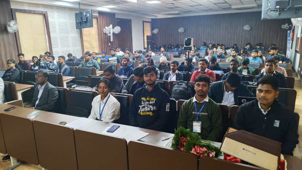
On the second day, a dynamic blend of technical insights and hands-on experiences unfolded, with the intellectual discussions taking place at A-26 and the practical explorations coming to life at the Computer Laboratory, Civil Engg. Dept. on December 10th, 2024.
The technical session commenced with the knowledgeable words of Dr. Maya Rajnarayan Ray, Associate Professor, BIT Sindri, Dhanbad, Jharkhand. Her topic of concern was the application of GIS in sustainable water resources management. She began her lecture by connecting knowledge of the Vedic period with modern-era achievements in GIS. As the lecture advanced, she threw light on various applications of GIS, ranging from agriculture, resource management, water resources management, infrastructure, slope stability analysis, etc. The lecture concluded with an elaborate explanation of the data structure of GIS.
After the short session, the event further unfolded with the bouquet presentation to the honorable guest speaker, Prof. Saroj Meena. Dr. Vikas Kumar Vidyarthi, Assistant Professor, National Institute of Technology (NIT) Raipur, Chhattisgarh, provided valuable insights into the application of remote sensing and machine learning (ML) techniques in the analysis and prediction of land use land cover (LULC).
The event continued with a memento presentation to the guest speaker by Dr. Jitu Kujur, Head, Department of Civil Engineering, BIT Sindri.
The 1st half concluded with Dr. Komal Kumari extending her gratitude to the director of BIT Sindri, the honored guests, faculty members, and students of the Civil Engineering Department.
The second session was about the cutting-edge world of remote sensing and geographic information systems, by Dr. Sucharita Pradhan, a scientist from the Krishi Vigyan Kendra (KVK) at OUAT, Bhubaneswar. With her vast expertise, Dr. Pradhan illuminated the huge role these technologies play in the transformation of watershed planning and management.
Further, the session advanced with the graceful words of Dr. Satiprasad Sahoo, water resources engineering, ICARDA, Egypt, who presented his practical knowledge on the fundamentals of the RS process, EMR spectrum, wavelength, and application.
On 3rd day, the speakers were Dr. B.D. Yadav from BIT Sindri, Dr. Suchitra Pradhan from OUAT Bhuvneshwar, Dr. Ratnakar Swain from NIT Rourkela, Dr. Satiprasad Sahoo from ICARDA Egypt, and Dr. Uday Mandal from ICARIISWC, who joined in hybrid mode.
A-26 witnessed technical insights and practical experiences from various fields of civil engineering, in which intellectual discussions and practical explorations were held at the Computer Laboratory of the Department of Civil Engineering.
The technical session commenced with the fruitful words of Dr. B.D. Yadav, Associate Professor, BIT Sindri, Dhanbad, Jharkhand. Through a series of case studies, Dr. Yadav showcased how GIS is being used in urban areas for coping with geotechnical problems; he also explored soil property mapping, and he took a case study of “Jharia Coalfield.”. Additionally, he mentioned global applications of GIS in the geotechnical industry. Finally, Dr. Yadav concluded his lecture with a discussion of the potential of GIS in monitoring agricultural and geotechnical engineering in the future.
Prof. Prashant Ranjan Malviya concluded the first technical session with a vote of thanks acknowledging the efforts of all attendees & participants.
The next session took a deep dive into the cutting-edge world of remote sensing (RS) and geographic information systems (GIS), led by the insightful Dr. Sucharita Pradhan, a distinguished scientist from the Krishi Vigyan Kendra (KVK) at OUAT, Bhubaneswar. With her wealth of practical experience, Dr. Pradhan illuminated the powerful role these technologies play in transforming watershed planning and management.
Program coordinator Dr. Komal Kumari took an opportunity to conclude the first half of the technical session.
The second session took a deep dive into the topic of visual interpretation of multispectral image classification, led by Dr. Uday Mandal, Senior Scientist in Soil and Water Conservation Engineering at ICAR-IISWC. Drawing, Dr. Mandal shared invaluable insights into the practical applications of remote sensing (RS) and geographic information systems (GIS) in groundwater potential zone mapping.
Continuing the session, Dr. Ratnakar Swain joined from NIT Rourkela and gave his valuable insights on the “Application of SAR Imagery in Flood Management.”
The event progressed with an enlightening address by Dr. Satiprasad Sahoo, water resources engineering, ICARDA, Egypt. With his wealth of practical experience, he graced the attendees. His words seamlessly bridged theoretical concepts with real-world implementation.
After a wonderful blend of theory and practical sessions, Program Coordinator Prof. Iqbal Sheikh concluded the second half of the technical session.
Dr. Jitu Kujur, the convener of this one-week workshop, praised the organizing committee and participants for showing up with full participation and progressing this event.
The event saw full participation from all graduate and postgraduate students of the department, professors, including Prof. (Dr.) Udai Kumar Singh, Prof. Prafulla Kumar Sharma, Dr. Maya Rajnarayan Ray, Dr. Nishikant Kisku, and Prof. Saroj Meena, contributed to making the event a colossal success.
The next day, sessions were organized at A26, Administrative Block, and the computer laboratory in the Civil Engineering Department.
The technical session commenced with a bouquet presentation to the guest of honor, Er. Shantanu Rai, AGM, BSNL, by Dr. Jitu Kujur and Chief Guest Dr. Mili Ghosh. Nee Lala, BIT Mesra by Dr. Komal Kumari.
During the welcome address, Dr. Jitu Kujur, Head of, the Civil Engineering Department and the convener of the workshop, welcomed the chief guest, guest of honor, and attendees.
Er. Shantanu Rai elucidated the paramount position remote sensing and GIS had acquired during modern times. He told the participants that this would open up many useful and impactful applications for all of them.
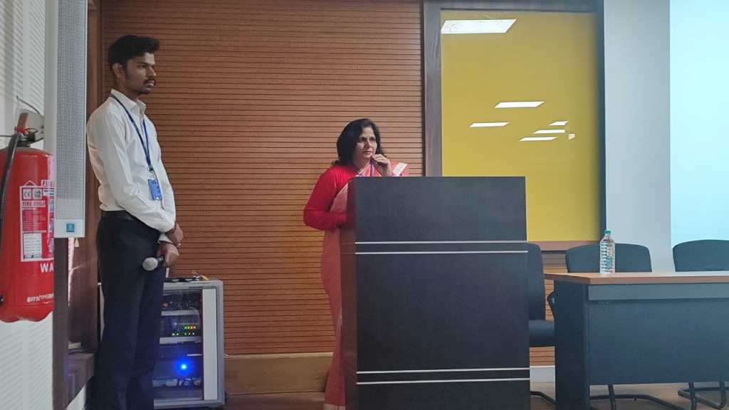
In the next session, the lecture on “Application of GIS in Geospatial Research” by Dr. Mili Ghosh Nee Lala, BIT Mesra, Ranchi, was quite an enlightening journey into the world of Geographic Information Science (GIS). Exemplary introduction defined GIS as a multidisciplinary field that plays a pivotal role in the collection, analysis, and management of geospatial data.
Dr. Maya Rajnarayan Rai gave a vote of thanks to end the first portion of the technical session.
Later at the end of the session, a memento was presented to the distinguished guest as a token of appreciation by Dr. Jitu Kujur, Head of the Civil Engineering Department, and a vote of thanks for the 1st technical session was contributed by Dr. Komal Kumari, praising the active participation of participants.
Pracs-Catchment Area delineation utilizing the GIS technology done during the session after lunch, emphasizing hydrological studies concerning watershed management and flood analysis, and other plans by Dr. Komal Kumari, an Assistant Professor at BIT Sindri in Dhanbad.
After the erudite words of Dr. Komal Kumari, the participants were further benefitted by a practical session by Prof. Iqbal Shaikh, Assistant Professor, BIT Sindri, Dhanbad. The session emphasized the application of remote sensing (RS) and geographic information systems (GIS) in contouring, and the participants were allowed to experience it practically, along with gaining valuable practical insights into the topic.
Undergraduate and postgraduate students from BIT Sindri and other institutions have actively participated. The efforts put in by Prof. (Dr.) Udai Kumar Singh, Prof. Prafulla Kumar Sharma, Dr. B.D. Yadav, Dr. Nishikant Kisku, Prof. Saroj Meena, and Prof. Prashant Ranjan Malviya led to this success.
The Department of Civil Engineering continued the 5th day of its one-week workshop on “Applications of Remote Sensing and GIS in Research,” sponsored by JCSTI Ranchi. The event was held in A26 and the Computer Laboratory on December 13, 2024. Sessions were taken by esteemed speakers, such as Dr. A.P. Krishna, professor of BIT Mesra, and Dr. Komal Kumari, BIT, of Sindri.
The session was inaugurated with a bouquet presentation to the honorable guest speaker by Dr. Jitu Kujur, Head of the Department of Civil Engineering.
In the welcome address, Dr. Kujur gave a warm and sincere greeting to the guest speaker and other guests in the room, thus making the atmosphere full of real warmth. In a gentle tone, Dr. Kujur conveyed gratitude for all those who were present there, mentioning the importance of the meeting and the richness of knowledge to be unleashed.
The knowledgeable words of Dr. A.P. Krishna, Professor, BIT Mesra, Ranchi, Jharkhand, followed by the topics he was concerned about—”Advanced tools and techniques of remote sensing and GIS” and “Remote sensing research application and advantages.” He discussed the use of multispectral and hyperspectral imaging for a detailed analysis of the earth’s surface and the benefits of the use of drones in small-scale, cost-effective data collection. He emphasized the crucial role of LiDAR and SAR in the exact mapping of geography and structures. Dr. Krishna discussed GIS software, including ArcGIS Pro, QGIS, and Erdas Imagine.
A memento was presented at the end of the session to the guest as a token of appreciation by Dr. Jitu Kujur, Head of the Civil Engineering Department.
The first part of the technical session concluded with the vote of thanks of Dr. B.D. Yadav.
After the lunch break, Dr. Komal Kumari, BIT Sindri, conducted a practical session on RS and GIS in water resources management.
A vote of thanks for the 2nd technical session was contributed by Prof. Iqbal Sheikh. He praised the active participation by students.
The workshop was actively attended by undergraduate and postgraduate students of BIT Sindri, along with other students from various institutions.